


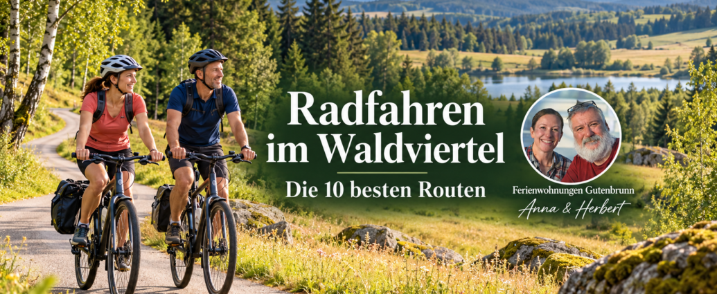
An Overview of the 10 Best Cycling Routes in the Waldviertel
Cycling in the Waldviertel takes you along the ten best routes through one of Austria's most peaceful cultural landscapes.
The selection is larger than most people expect.
For vacation rentals Gutenbrunn Every week, we have guests who ask the same question: Which route is right for us?
This overview answers those questions.
The Waldviertel is a hilly landscape of granite, ponds, and dense forests.
It's easy to plan a route for cycling in the Waldviertel.
That's why you can plan a relaxing day if you choose the right route.
If you make the wrong choice, after 40 kilometers of riding into the wind, you'll find yourself facing a climb that no one in the family had planned.
That's exactly what this is all about: not the longest list, but the most honest assessment of which bike path suits which type of rider. The routes are free to ride and open to the public; the infrastructure ranges from seamless signage to sections where you should charge your bike beforehand.
Comparison Table: Length, Elevation Gain, and Difficulty Level
| Route | Length | Elevation gain | Difficulty | Ideal for |
|---|---|---|---|---|
| Thaya Round | Approx. 100 km (sections possible) | low | slightly | Families, leisure cyclists |
| Kamp-Thaya-March Bicycle Route | approx. 235 km total | medium | medium | Multi-day tours |
| Iron Curtain Trail (EuroVelo 13) | 329 km in the region | over 2,000 m | heavy | Touring cyclists, MTB |
| Thaya Valley Bike Trail | variable, daily stages | low to moderate | slightly | Nature lovers |
| Waldviertel Bicycle Route | Approx. 365 km loop | high | heavy | Sporty Drivers |
The numbers highlight the fundamental problem with many route portals: They list distance and elevation gain, but say nothing about what a route is actually like when you’re traveling with children, a dog, or an e-bike. That’s exactly what we’re adding.
Thayarunde: Cycling Along Former Railroad Tracks for the Whole Family
The Thayarunde is a cross-border bike path that follows former railroad tracks, making it the flattest option on this list. Because the route was built for trains, there are hardly any inclines, the surface is paved throughout, and the route runs away from the main roads.
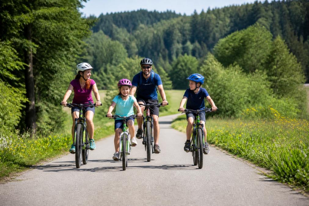
What makes the Thaya Loop so convenient for families is that it can be broken up into sections. You don’t have to ride the entire loop; instead, you can choose a section and rejoin the route at the next town. The connection to the Iron Curtain Trail expands the options for anyone looking for more.
One drawback we always mention to guests: In remote areas, the network of e-bike charging stations is sparse. If you’re riding with motor assistance, it’s best to plan your route so that you can take a break at an inn or tourist office along the way.
Ride the Thayarunde in the opposite direction of the main flow of traffic—that is, not the way the signs are generally laid out. On busy weekends, this spreads out encounters with other cycling groups much more evenly, especially on the narrower sections.
Kamp-Thaya-March Bike Route: The long-distance bike trail through three river landscapes
The Kamp-Thaya-March Bicycle Route connects the three rivers from which it takes its name and is the region's classic long-distance bicycle route. It winds through river landscapes, forested areas, and a high concentration of cultural landmarks.
Who is it best for? For cyclists planning a multi-day trip who value consistent signage. The route is well connected to the public transit system, which makes planning stages easier: You can cycle one stage and take the train or bus back.
The real catch is the total length. If you want to ride the entire route, you'll need stamina and time. Our recommendation for first-time visitors: skip one section—don't do the whole route.
Iron Curtain Trail (EuroVelo 13): Experience History on Two Wheels
The Iron Curtain Trail runs along the the former border and spans 329 kilometers through the region. The surface alternates between asphalt, gravel, and forest trails, and the topography involves a climb of over 2,000 meters in elevation.
This isn't a bike path for a leisurely afternoon. It's a route for people who want to combine history with cycling. Historical insights into the era of the Iron Curtain are an integral part of the route—not just an afterthought to be picked up along the way.
What many people underestimate: The mix of surfaces means that a pure road bike isn’t the best choice here. A touring bike or mountain bike with wider tires makes the gravel sections much more comfortable.
Family-Friendly Bicycle Trails in Lower Austria: Staying Safe on the Road with Children
Family-Friendly Bicycle Paths in Lower Austria In practice, this means: routes with little traffic, gentle inclines, and short distances between places to take a break. The Thaya Loop and the Thaya Valley Bike Trail best meet these criteria.
A loop trail is almost always a better choice for children than a round-trip route. The reason is psychological: Children know the destination and can estimate how far they still have to go. On a round-trip route, the question „How much longer?“ comes up twice on the way back.
Family logistics play a bigger role in success than the route itself:
- Limit the length of each stage to a maximum of 20 to 25 kilometers per day
- Plan for a rest stop with seating and a restroom—not just a bench by the side of the road
- Check the return trip by train or bus in advance, in case the children get tired
- Check in advance whether you can bring your bike on public transportation
- Bring your own drinks and snacks, because not every section has food and beverage options
Don't plan your return trip on a hunch. Bike transport on buses and trains is limited during peak season, and if you count on catching the last train, you might end up at the station with tired kids and bikes—at worst. Check the capacity before you leave.
Athletic Challenges: The Waldviertel Bike Route and Elevation Gain
The Waldviertel Bike Route is a loop of about 365 kilometers and the most challenging option on this list. It covers the entire region and winds through the area’s characteristic forests and rolling hills. If you plan to ride it all in one go, you should realistically allow four to five days.
The word „hilly“ doesn’t quite do the Waldviertel justice. The elevation gain adds up over the course of the day, and anyone riding the loop in just a few days will notice it by the third day. For ambitious cyclists, that’s exactly the appeal: the route rewards riders with sections you wouldn’t see on a short day trip.
What sets this route apart from flat railroad tracks is the variety of surfaces. Paved sections alternate with gravel sections and forest trails. In practice, this means that a pure road bike with 25-mm tires is the wrong choice. A touring bike with 35- to 40-mm-wide tires or a gravel bike is better suited to the demands of the route.
When planning the stages, it has proven effective to spread out the elevation gain evenly rather than concentrating it all in a single day:
| Stage | Character | Facing | Recommendation |
|---|---|---|---|
| Northern Section | undulating, with many short climbs | mostly asphalt | for the first day, to get into the swing of things |
| Eastern Section | longer uphill sections, forest trails | Asphalt and Gravel | second or third day |
| Southern Section | Pond landscape, shallow | Asphalt | Plan it as a day of rest |
| Western Section | the most challenging climbs | Gravel and forest trails | only with well-rested legs |
The accommodation infrastructure along the route is well-developed, making multi-day cycling trips feasible. Anyone planning their daily mileage should expect to cover 60 to 80 kilometers per day, not 100. The reason lies not in the distance, but in the total elevation gain: A day with 70 kilometers and many short climbs feels longer than a flat day with 90 kilometers.
A mechanism that many people underestimate: the brakes. On long gravel descents, rim brakes lose a significant amount of effectiveness in wet conditions. Anyone planning to do the loop should check their brake pads before setting out and, if using disc brakes, check the pad thickness. This is no exaggeration—it’s the most common reason why riders end up needing a repair stop in the middle of the tour.
Don't plan the most challenging section for the last day. If you save the western leg—with its steepest climbs—for the final day, you'll be riding it with tired legs and risk missing your return trip. It's better to schedule the tough leg in the middle and follow it with a flatter one to recover.
A different calculation applies to e-bike riders. The 365-kilometer route, with over 2,000 meters of elevation gain, is feasible with motor assistance, but only if a charging infrastructure is planned. A 500 Wh battery realistically lasts for 60 to 80 kilometers on medium assistance and hilly terrain. Those riding the full loop will need either a second battery or a route plan that includes a charging station at each day’s destination. The tourist offices along the route are the most reliable places to turn to for this, as they know the current charging locations.
E-Bike Rentals in the Waldviertel for Day Trips: What You Need to Know
For many visitors, renting an e-bike in the Waldviertel for day trips is a great way to get started, as the hilly landscape becomes much more accessible with motor assistance. Rental stations are available at tourist offices and partner businesses. Prices vary depending on the provider and rental duration.
Anyone considering an e-bike should keep two things in mind beforehand. First: Availability is limited during peak season, so it’s a good idea to make a reservation. Second: The charging network isn’t comprehensive. An 80-kilometer route with two long climbs can be a tight squeeze on an e-bike if there are no charging stations along the way.
Here's how to plan your trip: First, choose your route; then check where the charging stations are located; and only then book the bike. Not the other way around.
| Planning Step | What to Do | Why |
|---|---|---|
| Select a route | Select a route based on difficulty | Determines battery usage |
| Check Charging Stations | Mark restaurants and tourist offices | Ensures the return trip |
| Reserve a bike | Contact the rental company well in advance | We're fully booked during peak season |
| Load GPX Data | Download the tour in advance to your device or smartphone | Signage is good, but not comprehensive |
Many visitors use Komoot for navigation while out and about because the maps for forest and dirt roads are accurate and the offline maps work well. The premium features, such as voice navigation, cost money, but the basic features are sufficient for a day trip.
Culinary stops and sights along the route
In the Waldviertel, leisurely cycling is not at odds with athletic routes; it’s simply a matter of planning your stages. The region is known for its cultural landscape, and there are many inns along the main routes.
Two things are particularly worth seeing. First, the Waldviertel poppy, which plays a more prominent role in the region’s cuisine than in most other areas. Second, the ponds, which serve as scenic features along the routes and offer great places to take a break.
When it comes to sightseeing, there’s a simple rule: If you want to visit cultural landmarks, plan for fewer kilometers. A route with five stops and 70 kilometers won’t work. One with three stops and 45 kilometers will.
The best route isn't the one with the most highlights, but the one where the highlights and the distance traveled go hand in hand. An inn with good food and a pond where you can stop for a break are worth more than three museums you just pass by.
Best Time to Visit, How to Get There, and Amenities for Your Cycling Vacation
The best time of year for bike tours in the Waldviertel is between May and September. During this period, the days are long, restaurants are open, and bike rental stations are staffed. However, if you’re flexible, you’ll find the most pleasant conditions outside of peak season.
The season has three clearly distinct periods:
- Mid-May through mid-June: The meadows are in bloom, temperatures are generally between 15 and 22 degrees, and the trails are still relatively quiet. The downside: some restaurants and cafes don't open until early June.
- Mid-June through late August: Peak season, with the warmest temperatures but also the most cycling groups on the main routes. If you're riding during this time, it's best to start before 9 a.m. to avoid the midday heat.
- September: The quietest month—and, for many, the best. Temperatures remain pleasant, restaurants are open all day, and the trails are much less crowded than in the height of summer.
A factor that affects daily planning: The Waldviertel region is located on a plateau and is known for its harsher climate. The temperature differences between the valley and higher elevations are noticeable, and the weather can change within a single day. If you’re riding in the spring or fall, be sure to pack a windproof layer—not just a rain jacket.
The easiest way to get there is via public transportation, which provides good coverage of the region. The Franz-Josefs-Bahn connects Vienna with its northern districts, and several major routes are within easy reach of the stations along the line (Vienna, Lower Austria, and Burgenland Subway). Regarding bicycle transport: It is generally permitted on regional trains, but is often limited on buses and, during peak season, depends on how full the vehicle is. If you are traveling by bike, check the transport policy before booking.
For planning cycling vacations, including finding accommodations, there are specialized websites that list bike-friendly establishments and provide suggested routes with difficulty ratings, such as Radtouren.at, the Austrian portal for cycling trips. There you'll also find service information about rental locations.
For on-site navigation, there is the official Waldviertel Tourism App with Interactive Bicycle Routes, which provides not only a map but also information on road closures and dining options. One drawback: It requires a mobile data connection to access all its features. Therefore, anyone riding in remote areas should download the maps in advance.
When it comes to infrastructure along the routes, there’s a general rule of thumb: On the main routes, there are plenty of places to eat and rest stops, while on the side roads, they’re few and far between. If you’re planning a route with long stretches between towns, you should bring your own drinks and food instead of relying on the next town.
If you want to use the region as a base for several tours, choose your lodging based on location, not just price. A central location can easily save you an hour of travel time per day. For multi-day cycling trips, it’s also worth choosing accommodations based on their proximity to a train station, as this makes the return trip after each stage much easier.
The best time to travel isn't when the weather is warmest, but when there's the best combination of accessible infrastructure, quiet trails, and pleasant temperatures. For most cyclists, that's September.
Safety and Equipment Tips for Bicycle Tours in the Waldviertel
Safety starts with your gear, not the trail. The most common problems our guests describe have little to do with the route and a lot to do with a lack of preparation.
A common mistake is choosing the wrong tires. The Iron Curtain Trail and the Thaya Valley Bike Trail have unpaved sections that become slippery in bad weather. A road bike with narrow tires is the wrong choice for these trails.
A second issue concerns the signage. It's good in the region, but not comprehensive. Anyone who relies solely on signs and hasn't downloaded a GPX file will find themselves at junctions with no guidance.
The basic amenities we recommend to guests:
- Helmet, even on flat sections
- Rain jacket, because the weather in the region changes quickly
- Bring enough water, since not every section has places to eat
- GPX file downloaded to a device or smartphone
- Tool kit with repair kit for gravel roads
- Cell phone with a fully charged battery and a power bank
What most guidebooks fail to mention: Your choice of lodging indirectly affects your safety. If you still have to ride 20 kilometers to your lodging after a long stage, you’ll be tired. Therefore, choosing lodging that’s close to the route isn’t just a matter of comfort—it’s a safety consideration.
That’s exactly where we come in. Ferienwohnungen Gutenbrunn is located so that several of the routes mentioned are within easy reach without a long drive. Our four apartments are wheelchair-accessible and wheelchair accessible, Vacation with Your Dog is possible, and the quiet location near the Lake Edlesberg makes coming home after the tour a pleasant experience. We provide personalized service—not through a hotline—and you book directly with us.
The biggest challenge when cycling in the Waldviertel isn’t the route—it’s choosing one. From family-friendly former railroad tracks to challenging loop routes with over 2,000 meters of elevation gain, the range of options is so wide that the wrong choice can quickly turn a short trip into a long day. Ferienwohnungen Gutenbrunn offers you the perfect base for your adventure: accessible apartments with personalized service from Anna and Herbert, plenty of space for families, and Dogs, and a location from which you can easily reach the Thaya Loop, the Thaya Valley Bike Trail, and long-distance bike trails without a long commute. Book directly with us and start your next tour from a place where you can truly unwind after your ride.
Frequently Asked Questions
Which bike trails in the Waldviertel are particularly suitable for families?
The Thaya Loop is ideal for families, as it follows former railroad tracks and has very few hills. The Thayatal Bike Trail, which runs along the Thayatal National Park, also offers a relaxing route through nature. Both routes are well-marked and run away from main roads. For families with younger children, we recommend shorter stages of 20 to 30 kilometers with places to stop for a leisurely break.
Are there well-maintained bike paths in the Waldviertel away from the main roads?
Yes, many bike paths in the Waldviertel run along dedicated routes or on side roads with little traffic. The Thayarunde uses paved former railroad tracks, while the Iron Curtain Trail mostly follows gravel and forest paths. The Kamp-Thaya-March bike route is fully signposted and avoids heavily trafficked roads. This allows you to explore the cultural landscape and nature parks safely and at a leisurely pace.
What is the best time of year for cycling in the Waldviertel?
The best time of year for bike tours in the Waldviertel is from May through September. During these months, temperatures are pleasant, the inns are open, and the bike trails are in good condition. Early summer offers blooming landscapes, while fall features peaceful routes and colorful forests. In midsummer, it’s best to set out early to avoid the midday heat.
Where can I find e-bike charging stations along the bike routes?
E-bike charging stations are available at many tourist offices, inns, and partner businesses along the main cycling routes. The Waldviertel Tourism app shows current locations and information about road closures. In remote sections of the Thayarunde, infrastructure is sometimes limited, so you should charge your bike before setting out. E-bike rentals for day trips in the Waldviertel are available from local providers.
Are the bike paths in the Waldviertel consistently marked?
Most of the main bike routes in the Waldviertel are signposted throughout, including the Kamp-Thaya-March Bike Route, the Thayarunde, and the Iron Curtain Trail. The signage complies with regional and international standards. For individual tours, it’s also worth using an app like Komoot with GPX data. That way, you can reliably find your way even on lesser-known sections.
Comments are closed, but trackbacks and pingbacks are open.