


Why the Waldviertel Offers Romantic Hiking Trails for Couples
Romantic hiking trails for couples in the Waldviertel wind through quiet forests, past ponds, and over rolling hills—and you don’t have to be a professional athlete to enjoy them. That’s exactly what makes the region between Yspertal, Kremstal, and Strudengau so popular with couples looking to spend time together.
The The Waldviertel is one of the most peaceful regions in Austria. Granite cliffs, dark forests, and small ponds define the landscape. Hikers here rarely encounter crowds.
We've organized the following routes by length, difficulty, and atmosphere. This way, every couple can find the right hike, whether it's for a short walk or a full day outdoors.
Official Hiking Map of Lower Austria
Easy Hikes in the Waldviertel: A Relaxing Outing for Two
Easy hikes in the Waldviertel are usually between 4 and 10 kilometers long and involve only a slight elevation gain. They’re perfect for couples who want to talk, take in the scenery, and enjoy themselves rather than work up a sweat.
What Matters on an Easy Route
A route is easy when three things come together:
- Route length: less than 10 kilometers
- Elevation gain: less than 150 meters of elevation gain
- Background: wide forest trails instead of narrow paths
Many trails in the Waldviertel are naturally well-suited for this. The terrain is gentle, and the trails are well-marked.
A common mistake is to focus solely on the distance in kilometers. An 8-kilometer route with constant ups and downs is more strenuous than a 12-kilometer route on flat forest ground. That’s why you should always check the elevation gain.
When planning easy routes, make sure that half the distance is covered before you stop for a break. That way, you can take breaks without underestimating the return trip.
Hiking Trails in the Zwettl District: Routes Offering Scenic Views and Tranquility
Hiking trails in the Zwettl district are considered particularly peaceful because they are located away from the major tourist attractions. Many routes wind through wooded countryside with occasional scenic overlooks.
Overview of Starting Points, Route Lengths, and Walking Times
The following table summarizes typical easy routes. The figures are approximate values taken from regional route descriptions and may vary depending on the specific route variation.
| Route | Starting Point | Length | Walking time | Elevation gain |
|---|---|---|---|---|
| Forest Pond Loop | Parking lot at the municipal office | about 5 km | 1.5 hours. | about 60 m |
| Granite Block Trail | Outskirts of town, hiking parking lot | about 7 km | 2 hours. | about 90 m |
| Highlands Loop Trail | Viewpoint at the edge of the forest | about 9 km | 2.5 hours. | approx. 120 m |
| Valley View Loop | Bus stop at the entrance to town | about 4 km | 1 hour. | about 40 m |
Before each hike, check the current route description and the trail number on the hiking map. Some sections are closed seasonally.
Road Maintenance and Road Closures in the Waldviertel Region
Walks in the Waldviertel for peaceful moments together
Walks in the Waldviertel are the easiest way to spend time together. You don't need any equipment, planning, or a specific time slot.
Take a loop walk of 3 to 5 kilometers. Walk slowly. Stop and enjoy the view when it's nice.
The best times are early in the morning and late in the afternoon. That's when the light falls softly across the meadows, and the paths are empty.
A pond by the side of the trail is worth more than a summit cross. Sit down. If you want to talk, talk. If you want to be silent, be silent.
Romantic stops along the route: scenic overlooks, ponds, and rock formations
Romantic stops along the route turn a hike into a day out together. In the Waldviertel, there are three types of places that are perfect for this—and each has its own best time of day.
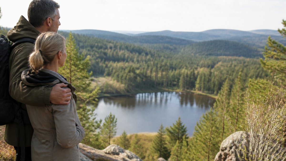
Viewpoints: small, unassuming; best visited in the late afternoon
Many viewpoints in the Waldviertel aren’t located on mountaintops, but rather at the edges of the forest, where the trees suddenly give way and the view opens up across the plateau. They’re often only a few meters wide, have no benches, and aren’t marked on the map. That’s exactly what makes them so peaceful.
The best time is in the late afternoon, when the sun is low in the sky and the granite boulders are bathed in warm light. In the morning, many of these spots are backlit and appear flat.
A practical tip: These forest edges are often found where a trail leaves the contour line. If you find a spot on the map where a trail turns from the plateau down into the valley, you’ll usually find a view there as well.
Ponds: the quietest places in the region
In the Waldviertel, ponds are not lakes in the traditional sense. They are usually small, dark bodies of water, often surrounded by forest, with a narrow path along the shore. The water contains peat and is therefore brown—this is normal and not a sign of poor water quality.
Ponds are great for couples for two reasons: they’re peaceful, and they offer natural places to sit. A fallen tree trunk on the shore is all you need. It’s a good idea to pack a towel or a thin seat pad in your backpack, since the ground along the shore is often damp.
The best time is early in the morning. That’s when there’s often fog over the water, and all you can hear are birds. Starting at noon in the summer, the ponds get warm and full of mosquitoes—so it’s better to move on then.
Granite rock formations: Take a break instead of climbing
Granite shapes the Waldviertel like no other landscape. The boulders are smooth and rounded, often piled one on top of the other and covered with moss and lichen. Many lie right along the path, while others are just a few steps away.
Important for Planning: Granite is at It's wet and slippery, even if it looks dry, gray, and harmless. If you want to climb onto a boulder, you should do so in dry weather and wear sturdy shoes. The flat area at the base of the formation is usually sufficient for taking a photo or taking a break.
How to Recognize a Good Stop
A good romantic stop has three characteristics:
- There are no signs for it. Signposted lookout points are usually the most crowded.
- It's located at a fork or bend in the road. The landscape there changes frequently.
- It has a place to sit. A rock, a tree trunk, or a bench—without a place to sit, a break turns into standing around.
The most beautiful stop is rarely the best-known one. Ask locals about small lookout spots off the beaten path—and make a point of planning your breaks rather than leaving them to chance.
Include stops in your itinerary
Allow 15 to 20 minutes for a lookout point and 30 to 45 minutes for a pond. If you plan to make two stops, you should add about an hour to the walking time for the route. Otherwise, a leisurely stroll will turn into a race against the clock—and that’s exactly what couples on a romantic hike want to avoid.
Choosing by Occasion and Mood: Which Hike Is Right for Which Day
The right route depends on the occasion, not on the number of kilometers. An anniversary calls for a different route than a Sunday stroll. The following four occasions cover most outings for couples—each with its own length, character, and specific itinerary.
First outing together: short, lots of views, a stop for refreshments at the end
The goal is to strike up a conversation without having to think about the route. Choose a loop of 4 to 6 kilometers with less than 80 meters of elevation gain and a place to stop for a break at the end. The trail should be wide and well-marked so you don’t have to constantly focus on the map.
Itinerary: Start late in the morning, take a short break at a scenic overlook halfway through, and then stop for a meal. This way, the day stays relaxed and doesn't end with you feeling exhausted.
Anniversary: A peaceful route with a special stop
It's not the length that matters here, but that one place you'll remember. Look for a route with a pond or a striking rock formation in the middle of the trail—not at the beginning and not at the end. The stop should be a highlight, not a starting or ending point.
Plan for 6 to 8 kilometers and plenty of extra time. Bring something to share: a small snack, a thermos, a blanket. The stop itself often takes longer than planned—that’s the whole point.
A rainy day: A forest trail lined with dense trees
When it rains, the problem isn't the distance, but the terrain. Avoid open plateaus, meadow trails, and anything near streams. Instead, look for dense coniferous forests that shield you from the rain and keep the ground from getting too soggy.
Keep the hike short: 3 to 5 kilometers. Bring a rain jacket, even if it’s dry when you start. And check beforehand to make sure the trail is actually passable—an overgrown trail isn’t much fun when it’s wet.
A Full Day for Two: A Loop Hike with Two Breaks
For a whole day Circular routes of 8 to 10 kilometers with an elevation gain of 150 to 250 meters are ideal. The circular nature of the route is important: on a one-way hike, you have to hike back at the end, and that’s often underestimated.
Plan for two breaks—one after about one-third of the way, and one after two-thirds. The second break is the more important one, because that’s when your concentration starts to wane. Be sure to bring plenty of water; in the Waldviertel, there are hardly any places to stop for refreshments outside of town.
The Two Questions That Matter More Than the Map
Ask yourself this first:
- Do we want to talk or watch? Walking requires wide, easy paths. Sightseeing requires vantage points and variety.
- Should we leave early or late? Early means fog and empty streets. Late means warm light and a quieter afternoon.
The answers to these two questions narrow down the options more effectively than any distance measurement. If you answer both honestly, you’ll usually find the right route in just a few minutes.
Practical Planning for Couples: Trip Planning, Hiking Map, and Gear
Good trip planning starts with three questions: How long, how steep, and how remote? Everything else depends on that.
Before the tour:
- Get a hiking map of the region or save it on your phone
- Write down the directions and the route number
- Check the weather forecast for today
- Set the starting point and parking location
Equipment for two:
- Sturdy shoes with treads
- Rain jacket, even when it's sunny
- Water and a small snack
- Cell phone with a fully charged battery
On the Road:
- Track your route to make the return trip easier
- Plan breaks—don't wait until you're exhausted
- Allow for a 30-minute time buffer
If you save the route beforehand and bring the directions with you, you won't have to argue about where to go along the way. That's more valuable than you might think.
Accessible and short alternatives for leisurely outings
Not every couple wants to hike uphill. There are plenty of short, accessible alternatives in the Waldviertel.
Look for paths with a wide surface and no steps. Many paths around ponds and through valleys meet these criteria.
Look for these characteristics:
- Width: at least 1.5 meters
- Gradient: as close to 5 percent as possible
- Tire tread: firm, not gravelly
- Bank: Seating at short intervals
This is crucial for guests who use wheelchairs or walking aids. At Ferienwohnungen Gutenbrunn, our four apartments are barrier-free and wheelchair-accessible., so that the walk from the room to the trail isn't a hurdle.
Be sure to check each section individually, though. Not every trail described as easy is actually accessible.
Seasonal and Weather-Based Recommendations for Romantic Hiking Trails
The season and the weather change every route. This is especially evident in the Waldviertel.
Spring: Soft paths, fresh greenery, but it's often still chilly. Be sure to bring a jacket.
Summer: Start early. By noon, it’s warm on the plateaus but pleasantly cool in the forest.
Fall: The best time of year for romantic hiking trails. Fog over the ponds, golden leaves, and few people.
Winter: Short walks on cleared paths. It gets slippery without sturdy shoes.
When it rains, avoid trails along streams and in the gorge. During a thunderstorm, don't set out at all. That's not just being cautious—it's common sense.
Weather Alerts for Lower Austria
Hike Responsibly and Stay Safe on the Trail
Hiking safely means being prepared and respecting nature. Both require very little effort.
Stay on the marked trails. This protects plants and animals and prevents you from getting lost.
Tell someone where you're going and when you'll be back. Take your cell phone with you, but don't rely on it, because there are dead zones in the woods.
Please take your trash with you. Otherwise, even small items will be left behind.
Don't underestimate the ride back. Many accidents happen at the end of a ride, when your energy is running low and your concentration is waning.
Check the local guidelines regarding nature reserves in advance. In some areas, you are required to stay on the trails, especially during the breeding season.
A group hiking day in the Waldviertel thrives on tranquility, good planning, and a place where you can truly unwind afterward. That's exactly what we're here for: Vacation Rentals Gutenbrunn offers four accessible and wheelchair-accessible apartments with a kitchen-diner and bedrooms, personalized care from Anna and Herbert, and a quiet location near natural attractions such as the Lake Edlesberg. Vacation with Your Dog You can book directly with us, without any third-party platforms. Start your next hike from Gutenbrunn and enjoy a break without the pressure of a tight schedule.
Frequently Asked Questions
Which hikes in the Waldviertel are best for couples?
Short loop trails with little elevation gain that wind through the forest and past scenic overlooks are particularly well-suited for couples. Easy hikes in the Waldviertel can be easily combined with a picnic or a quiet stop by a pond. Plan for a walking time of one to two hours so you’ll have enough time to linger. A hiking map or a hiking app can help you check trail numbers and starting points in advance.
How long should a romantic hike last?
A romantic hike doesn’t have to be long. Two to three hours are usually enough to cover the route, take in the views, and enjoy breaks together. If you prefer a more leisurely pace, choose a walk of about an hour. Plan your walking time generously and factor in the ascent and descent. That way, the day stays relaxed, and you can truly enjoy the tranquility of the Waldviertel.
What should you pack for a hike as a couple?
For a hike for two, pack water, a small snack, a rain jacket, and sunscreen in your backpack. Sturdy shoes are a good idea on forest trails, even if the route is easy. A hiking map or a hiking app with a saved route makes it easier to find your way. If you’re bringing a dog along, remember to pack water for your pet. That way, you’ll be well prepared for changes in the weather and longer breaks.
Where can you go for particularly peaceful walks in the Waldviertel?
You can enjoy peaceful walks in the Waldviertel on quiet forest and meadow trails off the beaten path. Trails along ponds and through wooded landscapes, where you’ll hardly encounter anyone, are especially pleasant. Look for marked loop trails with a low difficulty level. If you set out early in the morning or during the week, you’ll often have the trail almost entirely to yourself.

Comments are closed, but trackbacks and pingbacks are open.