


The Sun Trail Gutenbrunn runs from the town center through Edlesberg until Lake Edlesberg. The officially designated winter hiking trail is 5.3 kilometers long and offers two routes. One leads from Edlesberg directly to the lake. The second passes by the wildlife preserve, continues along the farm road to Roßmühle, and then also leads to the lake.
For guests staying in our vacation rentals, the trailhead is particularly convenient. It is located near the P1 parking lot at the Gutenbrunn municipal office. Our map also shows the location of the Gutenbrunn 133 vacation rentals and the direction to the official starting area.
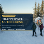
Gutenbrunn Sun Trail at a Glance
- Official length: 5.3 km
- Introduction: near Parking Lot P1 at the Gutenbrunn Municipal Office
- Starting elevation according to the official plan: about 844 m
- Highest point according to the official map: about 894 m
- Target range: Edlesberg and Lake Edlesberg
- Variants: directly to the lake or via the wildlife preserve and Roßmühle
- Return trip: From Edlesberg back to Gutenbrunn
- Character: Winter hiking trail along roads, farm roads, and mapped trails
- Estimated walking time: About 1.5 to 2 hours, depending on the snow conditions and the route chosen
The local website does not specify an official difficulty level or walking time. The estimated time required is therefore only a practical guideline. Deep snow, icy patches, and winter footwear can significantly affect your walking pace.
Route of the Gutenbrunn Sun Trail
The Gutenbrunn Sun Trail begins near the municipal office. From parking lot P1, the trail first leads out of town toward Edlesberg. Even on this section, beautiful views of the typical Waldviertel hilly landscape open up.
The trail gradually gains elevation. Winding through meadows, past scattered houses, and through patches of forest, it leads to Edlesberg. There, the two officially mapped routes to Lake Edlesberg diverge.
Option 1: Directly from Edlesberg to the lake
The first route goes from Gutenbrunn to Edlesberg and from there takes a more direct path to Lake Edlesberg. It is suitable for visitors who want to experience the lake as their destination but would prefer to skip the additional section to Roßmühle.
Our map estimate, based on the official map, shows that the direct round trip is approximately 3.9 kilometers. This figure is not an official route length and is not derived from an official GPX file. The signage and the actual trail conditions on site remain the deciding factors.
Option 2: via the wildlife preserve and Roßmühle
On the second route, the Gutenbrunn Sun Trail leads from Edlesberg past the wildlife reserve. It then follows the farm road to the Roßmühle and from there reaches the area near Lake Edlesberg.
The map-based estimate for this longer route is about 5.1 kilometers. This matches well with the officially stated trail length of 5.3 kilometers. Minor differences arise from the old overview map, the chosen starting point, the current trail route, and the technical method of distance calculation.
From Edlesberg, both routes lead back to Gutenbrunn. Once there, please follow the posted direction of travel and be aware of any winter-related changes.
Why the Sonnenweg Is Worth Visiting in Winter
The Sonnenweg Trail connects several different landscapes over a short distance. The hike begins in Gutenbrunn, near the town center. It then passes through open meadows, small settlements, and peaceful stretches of forest. Around Edlesberg, the landscape opens up and offers beautiful views.
In winter, a particularly serene atmosphere settles over Lake Edlesberg. Snow muffles sounds, and the forests are reflected in the dark waters or frame the frozen surface. The lake is a beautiful hiking destination, although you must never walk on the ice without express permission.
The longer route adds a walk around the wildlife preserve and the Roßmühle mill. This turns the direct path to the lake into a more varied loop that offers a better view of the surrounding landscape.
Winter Hiking for Hotel Guests
For vacationers, the Sonnenweg Gutenbrunn is an easily accessible winter destination. There’s no need for a long drive. You can quickly reach the starting point near the town hall from your vacation rental and then hike at your own pace.
This tour is perfect for a relaxing day on vacation. It’s long enough to let you fully experience the winter landscape, yet it’s much more manageable than an extended day hike. After you return, you can spend the afternoon or evening relaxing in your vacation rental.
If you'd like to learn more about the hike's destination, check out our post on Lake Ednesberg near Gutenbrunn Additional information. Another option for a nature trail through a protected forest is the Diebsweg, Gutenbrunn to.
Directions to Sonnenweg Gutenbrunn
The official entrance is located near Parking Lot P1 at the Gutenbrunn Municipal Office. The town hall is located in the town center. The starting area is accessible from the Gutenbrunn Vacation Rentals 133, 3665 Gutenbrunn Easily accessible.
On our map, the lodging is marked with its own icon. The gold dotted line schematically shows the direction to the trailhead. It is not part of the winter hiking trail and is not a substitute for street-level navigation.
Park only in designated areas. Access routes for snow removal, emergency vehicles, and residents must remain clear. In snowy or icy conditions, winter tires and cautious driving are required.
Note on the Orientation Map
There is currently no official GPX file available for the Gutenbrunn Sun Trail. The municipality, or rather ARGE Winter, provides a map of the winter hiking trail. This map shows the general route and the two variations, but does not include any digital GPS waypoints.
Our map overlays the route described onto mapped paths from OpenStreetMap. It shows:
- the shared route from Gutenbrunn to Edlesberg,
- the direct connection to Lake Edlesberg,
- the longer route via the Roßmühle,
- the official starting area at the municipal office,
- The location of the Gutenbrunn 133 vacation rentals.
That is why the lines are Orienteering courses, not official GPX tracks. On site, only markings, signs, barriers, and the path that is actually cleared or accessible apply.
Lake Edlesberg in Winter
Lake Edlesberg, also known locally as Edlesberg pond ...is situated in a peaceful setting between the forest and meadows. In winter, it is an atmospheric destination for walkers and nature lovers. The shoreline and the access point near the Seewolf Guesthouse are important landmarks.
Do not step onto a body of ice unless it has been expressly deemed safe. Ice that appears to be solid may have varying levels of strength near tributaries, along the shore, and under a blanket of snow. For a winter hike, simply look out from the safety of the shore.
Please respect nature even at the lake. Stay on the designated trails, avoid making unnecessary noise, and take your trash with you when you leave.
Equipment for the Sun Trail
For a winter hike, sturdy, water-repellent shoes with non-slip soles are important. Regular lightweight casual shoes often don’t provide enough traction on snow and ice. Hiking poles can provide extra safety on steep slopes and slippery sections.
Essential equipment includes:
- warm clothing worn in layers,
- weatherproof jacket and gloves,
- sturdy winter boots or hiking boots,
- appropriate crampons or shoe spikes for icy conditions,
- Hiking poles tailored to your personal needs,
- A drink and a small energy reserve,
- charged cell phone,
- Maybe a small headlamp.
The days are short in winter. Plan your hike so that you have enough time for the return trip. Fog and snowfall can further reduce visibility.
Safety and Consideration
Groomed winter hiking trails may still be slippery even after being cleared. Walk slowly and expect ice on shaded sections. Extra caution is needed after a thaw followed by another freeze.
Some of the trails in the Gutenbrunn winter program are located near cross-country ski trails. Do not step onto a classic-style track or walk on a skating track. Cross-country ski trails may only be crossed at the designated crossings. This helps preserve the tracks and prevent collisions.
For hikes with children or older guests, you should check the current trail conditions very carefully. The distance listed does not indicate whether there is ice, the depth of the snow, or how slippery the trail is.
Check the current winter conditions
Whether the Sonnenweg is cleared or easily accessible depends on snowfall, wind, temperature, and ongoing maintenance. The local winter website provides information about groomed winter hiking trails and the status of winter sports activities.
Immediately before takeoff, check the Gutenbrunn's latest winter report. On-site signs and closures always take precedence. In the event of a storm, heavy ice buildup, or poor visibility, a hike in the woods should be postponed.
Frequently Asked Questions About the Gutenbrunn Sun Trail
How long is the Gutenbrunn Sun Trail?
The official winter hiking website lists a length of 5.3 kilometers. This figure best matches the longer route through the wildlife preserve and past the Roßmühle. The direct route to the lake is likely shorter.
Where does the Sonnenweg begin?
The trailhead is located near Parking Lot P1 at the Gutenbrunn Municipal Office. Our map also shows directions from the Gutenbrunn 133 vacation rentals.
What are the two options?
Route 1 leads from Gutenbrunn through Edlesberg directly to Lake Edlesberg. Route 2 starts in Edlesberg, passes by the wildlife preserve, follows the farm road to Roßmühle, and then continues to the lake.
Is there an official GPX file?
No. The official website provides a hand-drawn winter hiking map, but no digital GPX track. Our map overlays the route onto mapped trails for orientation and is labeled accordingly.
Is the trail suitable for children?
For children who are used to hiking, the distance is generally manageable. However, the depth of the snow, icy conditions, temperature, and sure-footedness are crucial factors. Families should choose the shorter route if conditions are challenging.
Is it allowed to walk on the frozen Lake Edlesberg?
Only with express approval from the authorities or local officials. A solid snow cover does not indicate the ice's load-bearing capacity.
Can the Sonnenweg be hiked without snow?
The official Sonnenweg is described as a winter hiking trail. To determine whether the same sections are accessible year-round, check the local trail markings and current signage.

Our Thoughts on the Gutenbrunn Sun Trail
The Gutenbrunn Sun Trail connects a trailhead near the town with Edlesberg, the Roßmühle, and Lake Edlesberg. The direct route and the longer route allow you to tailor the hike to your fitness level, the weather, and the time you have available.
One of the best things for guests staying at the inn is that the starting point is just a short distance from the inn. If you're looking for winter tranquility, open countryside, and a beautiful destination by the water, you'll find the perfect tour here.

Comments are closed, but trackbacks and pingbacks are open.