


Table of Contents
- Accessible Bike Paths in Lower Austria – Destinations for E-Bikes
- Accessible Bicycle Tours in the Waldviertel and Surrounding Areas
- Bicycle Paths for Wheelchair Users – Requirements and Features
- How to Properly Plan Your E-Bike Range for Day Trips
- Cycling Maps and Route Planners for Lower Austria
- Safe cycling routes and low-traffic paths
- Sights and rest stops along the route
- Practical Tips for Accessible E-Bike Trips
- Conclusion – Stress-Free, Accessible Bike Tours
- Frequently Asked Questions
Last updated: October 16, 2026
Accessible Bike Paths in Lower Austria – Destinations for E-Bikes
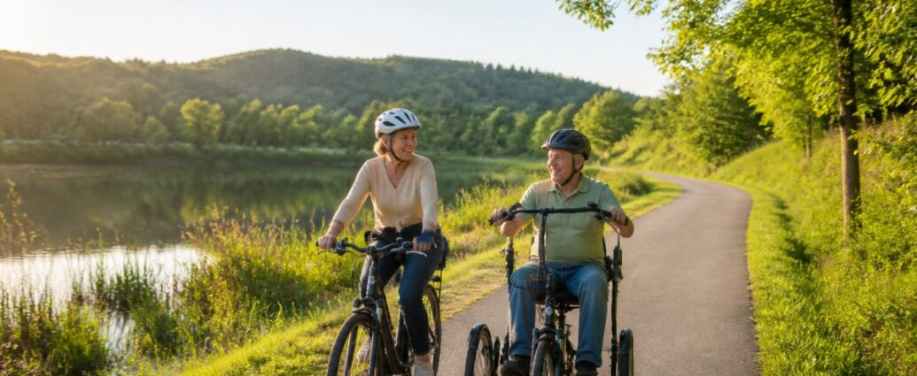
Cycling is one of the best ways to enjoy nature. But not all bike paths are equally accessible. If you have limited mobility, you need reliable information about accessible bike paths for e-bikes for trips in Lower Austria.
The good news: There are more options than you might think. Many bike routes in the region are flat, well-maintained, and perfect for e-bikes. You just need to know where to look.
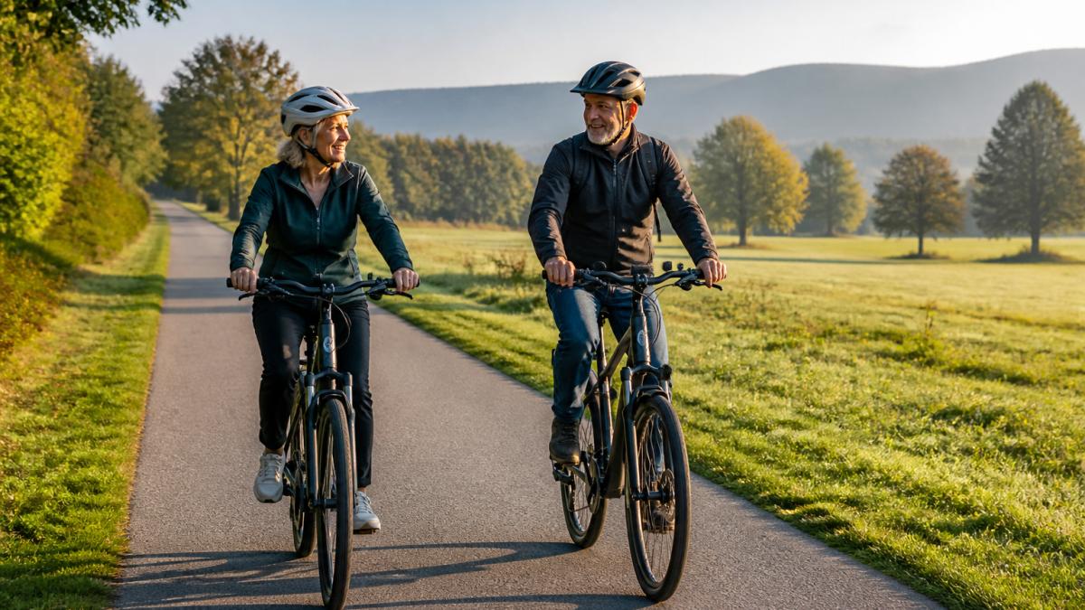
At Ferienwohnungen Gutenbrunn, we understand that your accommodations should be the starting point for wonderful experiences. Our accessible vacation rentals are located in the Waldviertel region—ideal for day trips by e-bike. We’ve researched which bike trails are truly accessible and how you can plan your tour safely.
Always plan your e-bike tour with some leeway. The actual range is often 10–15% lower than the manufacturer's specifications—especially on hilly terrain or in strong winds.
Accessible Bicycle Tours in the Waldviertel and Surrounding Areas
The Waldviertel offers a surprising number of accessible bike tours. The region isn't as mountainous as other parts of Austria, which makes it ideal for e-bikes and wheelchair users.
Flat routes with good trail conditions
Flat bike paths are the foundation for accessible bike rides. They allow people with varying mobility needs to ride long distances comfortably. A good bike path has a level, paved surface without potholes or unexpected inclines.
The best accessible bike tours in the Waldviertel often follow river courses or historic trade routes. These routes have been maintained for centuries and are therefore particularly well-preserved. Paved surfaces or compacted gravel are the norm—not loose gravel or forest trails.
Look for bike paths that are marked as „car-free“ or „low-traffic.“ This means you won’t be sharing the path with cars. That makes riding safer and more enjoyable, especially for people who ride more slowly.
Flat bike paths with a paved surface throughout are essential for accessible bike tours. Avoid forest trails or gravel paths—these are unsuitable for e-bikes ridden by wheelchair users or people with limited mobility.
Routes along rivers and scenic routes
Rivers are natural transportation routes. They flow through flat terrain and connect small towns. This makes them perfect for accessible bike paths.
The Kamp and the Thaya are the region’s most important rivers. Both have well-developed bike paths along their banks. These paths not only offer good riding conditions but also ever-changing views of the water, forests, and meadows.
Scenic routes connect several points of interest. They are often better maintained than individual forest trails because they are regularly inspected by tourism associations. That means fewer surprises along the way.
Bicycle Paths for Wheelchair Users – Requirements and Features
Accessible bike paths for wheelchair users have specific requirements. They differ from standard bike paths in terms of width, surface texture, gradient, and freedom from obstacles. People who ride handcycles, tricycles, tandems, or e-bikes need different information than a family with a trailer. This section outlines the most important features and explains what you should look for when choosing a route.
Trail Conditions and Gradients
The surface condition determines whether a bike path is accessible to wheelchair users. Asphalt is ideal. Compacted gravel works, but only if it is truly compacted and not loose. Loose pebbles, sand, or forest soil are unsuitable for narrow wheelchair tires and hand bikes because they increase rolling resistance and make it harder to maintain a straight path.
Grades are the second critical factor. A grade of up to 3% is comfortable. Up to 6% is manageable, but strenuous. Anything beyond that becomes problematic. An e-bike helps, but even with a motor, the wheelchair user needs arm strength—especially with hand bikes that lack electric assistance.
Curves should be wide—not tight or unexpected. Tight turns make steering difficult and increase the risk of falling. Narrow passages, bollards, grating, and curbs are common tripping hazards that aren’t marked on any map. Be sure to ask the tourist information office specifically about such areas before planning a route.
| Characteristic | Requirement | Why It's Important |
|---|---|---|
| Surface Type | Asphalt or compacted gravel | Sturdy wheels, no jamming |
| Slope | Maximum 6%, ideally less than 3% | The rider's strength and endurance |
| Width | At least 2 meters | Safety and Comfort While Driving |
| Lateral tilt | Maximum 2% | Prevents Sideways Drift |
| Obstacles | No steps, railings, or bollards | Unrestricted travel without detours |
| Bottlenecks | At least 90 cm clearance | Accessibility for hand bikes and tricycles |
Suitability for Different Mobility Needs
Not every accessible bike path is suitable for every vehicle. A quick guide can help you choose:
- Handbike: Requires a solid surface throughout, as gentle a slope as possible, and sufficiently wide passageways. Narrow passages less than 90 cm wide and sharp turns are problematic.
- Electric wheelchair: Take advantage of flat, paved routes and short distances between rest stops. Avoid inclines steeper than 6%.
- Tricycles and Tandems: require more width and wider turning radii. Turning and swerving are more difficult than on a two-wheeler.
- E-bike with a trailer: Requires paved paths and enough space at narrow spots. Gravel sections are much more difficult to navigate with a trailer.
This classification is no substitute for an on-site inspection, but it does make it easier to compare tour options. If you know the route in advance, you can ask specific questions and avoid surprises.
Rest areas and accessible infrastructure
A good bike ride needs places to take a break. Rest areas should be easily accessible—without steps or steep ramps.
Accessible infrastructure means:
- Flat rest areas with tables and benches
- Restrooms with ample space for wheelchairs
- Drinking Water Stations
- Shaded areas for breaks during hot weather
Many rest areas in the region are not yet fully accessible. That’s why it’s a good idea to do some research in advance. Check with the tourist information office to find out which rest areas are truly accessible, and make a note of their phone numbers for when you’re on the road.
Not all signposted rest areas are truly accessible. A rest area with a „wheelchair-accessible restroom“ may still have steps at the entrance. Ask in advance or check out the route beforehand, if possible.
For wheelchair users, the surface, slope, width, and absence of obstacles are what matter—not the length of the route. Check these four factors before every trip and plan breaks at accessible rest areas.
How to Properly Plan Your E-Bike Range for Day Trips
Range is the be-all and end-all when planning accessible e-bike tours. Planning that’s too short leads to dead batteries and stress. Planning that’s too conservative wastes potential. If you know the key factors, you can realistically estimate your range and plan charging options accordingly.
Battery Capacity and Realistic Range
Range depends on several factors. The battery is just one of them. Terrain, weight, riding style, tire pressure, and weather all play a major role.
A modern e-bike battery with a capacity of 500 Wh (watt-hours) typically provides a range of 50–80 km on flat terrain. With 750 Wh, the range is 75–120 km. These figures are estimates—not guaranteed. In the Waldviertel region, the terrain is mostly flat to gently rolling. This is favorable for range. However, wind can make a big difference. Headwinds reduce the range by 10–20%.
Realistic Planning for a Day Trip:
- Total range: up to 70%, according to the manufacturer's specifications
- Allow for a buffer: 15–20 km in reserve for detours or headwinds
- Plan Your Charging Stop: It's Better to Charge Too Early Than Too Late
- Choose your assistance level carefully: a lower level saves battery life but requires more effort
Charging stations, charging options, and alternatives when the battery is dead
A charging station along the way makes long trips possible. A 30-minute quick charge often gives you an additional 30–40 km of range. Charging stations are not yet widely available throughout the region. But progress is being made. Many inns and tourist information centers now offer charging options—call ahead of your trip to ask if charging is available and during what hours.
When planning, it helps to divide the route into sections and plan a charging option or a return route for each section:
- Travel to and from the lodging: If you can charge your e-bike overnight, you'll start every day with a full battery. This makes longer rides possible and reduces stress.
- Charging break at the turnaround point: Plan your route so that you stop at an inn or a tourist information center with charging facilities. That way, the battery will last for the return trip.
- Alternative if the battery is dead: It’s hard to pedal an e-bike without the motor. Therefore, plan to return by train or bus, and check in advance whether you can bring your bike on board. Make a note of the number for a local taxi or transportation service in case of an emergency.
At Ferienwohnungen Gutenbrunn, you can charge your e-bike overnight. That way, you can start each day with a fully charged battery. This makes longer rides possible and reduces stress.
Don't wait until you reach the turnaround point to charge the battery; charge it during your first break instead. That way, you'll have more power in reserve for headwinds or detours on the way back.
Plan your range conservatively, divide the route into sections, and determine a charging option or a way to return for each section. That way, a long trip won't turn into a battery-draining adventure.
Cycling Maps and Route Planners for Lower Austria
Good planning starts with good maps. Digital route planners and printed bike maps both have their advantages.
Interactive maps show elevation, terrain type, and traffic conditions. You can adjust your route in real time. This is especially helpful when you're on the go.
Printed cycling maps are available offline. They work even without a battery in your smartphone. Many people bring both—better safe than sorry.
The Lower Austria Cycling Map shows regional bike trails with difficulty ratings. This is your starting point for accessible bike trails.
Route planners such as Komoot or Strava allow you to filter by difficulty and surface type. You can search specifically for flat, paved paths.
Take advantage of the community features in route planners. Other users often post tips about obstacles or problems. This will save you time and frustration when planning your route.
Safe cycling routes and low-traffic paths
Safety isn't just a matter of infrastructure. It also has to do with traffic volume and visibility.
Car-free bike paths are ideal. They are separate from roads and have no car traffic. This makes them safer and more pleasant—especially for people who ride more slowly.
Low-traffic roads have little car traffic, but not none at all. They are often country roads with good visibility and wide shoulders. When riding on such roads, make sure you’re extra visible. Reflectors and lights help.
There are several car-free bike paths throughout the region, such as parts of the Thaya Bike Path and several circular routes in the Waldviertel.
These trails are not only safe but also scenic. They wind through vineyards, forests, and small villages.
Sights and rest stops along the route
Bike rides are more than just exercise. They're also an opportunity to discover new places.
The Waldviertel has many attractions that are easily accessible from the bike path. Lake Edlesberg is a popular destination. It is located near several bike paths and has accessible entry points.
Small villages along the route often have inns and cafés. Many cater to cyclists and offer water, snacks, and restrooms.
Be sure to plan for rest stops. It’s a good idea to take a break after 20–30 km—especially for people with limited mobility. A 15-minute break often makes a big difference.
Sights along popular routes:
- Historic Mills and Castles
- Nature Reserves with Viewpoints
- Wineries Offering Wine Tastings
- Arts and Crafts and Local Markets
Practical Tips for Accessible E-Bike Trips
Experience helps. Here are some practical tips based on real-world experience.
Start early. The earlier you leave, the more time you'll have. This reduces stress and gives you some leeway for breaks or detours.
Check the weather. Wind is the biggest factor that reduces your range. Don't ride the longest distances when you have a headwind. Take advantage of a tailwind for longer rides.
Bring a companion. Having a second person with you makes the tour more enjoyable. You can also help each other out if something goes wrong.
Don't forget to eat and drink. Dehydration and low blood sugar make cycling unpleasant. Bring more than you think you'll need.
Plan for breaks. Don't drive nonstop. Taking regular breaks keeps you alert and safe.
Check your insurance. Ask your health insurance provider if cycling with mobility limitations is covered. This will give you peace of mind.
The best way to prepare is to plan realistically. Know your limits, plan conservatively, and enjoy the ride. Accessible bike paths aren’t slower—they’re just different.
Conclusion – Stress-Free, Accessible Bike Tours
Accessible e-bike tours in Lower Austria are possible. The region has flat trails, good infrastructure, and many attractions. All you need is the right planning.
Choose routes that are truly accessible. Not all signposted paths live up to their promises. Do your research beforehand or ask for directions when you get there.
Plan your e-bike range realistically. Be conservative in your estimates and build in a buffer. That’s the difference between fun and stress.
Take time for breaks and sightseeing. Cycling isn't a race. It's about enjoyment and exercise.
At Ferienwohnungen Gutenbrunn in the Waldviertel, you’ll find the perfect starting point for accessible e-bike tours. Our accessible vacation apartments offer you comfort, personalized service from Anna & Herbert, and a central location for day trips. Charge your e-bike overnight, set out well-rested, and enjoy nature without feeling rushed.
Austrian tourism associations with information on accessible cycling
Frequently Asked Questions
How can you tell if a bike path is truly accessible?
An accessible bike path is characterized by level, paved surfaces—ideally asphalt or compacted gravel. Key features include minimal gradients (less than 5 %), wide paths (at least 2.5 meters), level crossings without steps, and regular rest areas with accessible benches. Official bike maps and route planners for Lower Austria often mark such routes with symbols indicating accessibility. Before booking accommodations, it’s a good idea to check with the hosts, who are familiar with local conditions from experience.
How do I properly plan the range of my e-bike for a day trip?
The range of an e-bike depends on battery capacity, motor assistance, terrain, and weight. Typically, you can expect 40–80 km per charge with moderate use. For day trips, plan realistically: Calculate the outbound trip with a buffer, then the return trip—ideally with a charging station nearby or at your lodging. Flat routes, such as those along rivers, require less battery power than hilly routes. Many rest stops in Lower Austria now offer charging stations; check with your route planner beforehand.
What types of road surfaces are suitable for wheelchair users and bicycles with trailers?
Asphalt and compacted gravel are ideal—they provide stability and are easy to ride on. Loose gravel, forest floors, or natural surfaces are less suitable. The surface should be level and free of deep ruts. For wheelchair users and those with trailers, wide paths (at least 2.5 meters) are important for safe travel. Check the current trail conditions before your trip—damage from rain or maintenance work can occur on short notice. Local hosts in the Waldviertel can provide up-to-date information on trail conditions.
Where can I find up-to-date cycling maps and reliable route information for Lower Austria?
The official Lower Austria cycling map is available online and in print and shows gradients, road surface quality, and traffic volume. The ‚Lower Austria Cycling Map‘ route planner offers interactive route planning with elevation profiles. Regional tourism associations also provide detailed tour descriptions. For information on accessibility, it’s worth contacting local accommodations directly—they know the routes from experience and can inform you of any current restrictions.
Cycling with mobility limitations requires planning—but it’s absolutely doable. Ferienwohnungen Gutenbrunn understands these needs. Book directly with us and enjoy barrier-free accommodations that are specially equipped to meet your needs. Our personalized service and ideal location in the Waldviertel make every day a successful day out.


Comments are closed, but trackbacks and pingbacks are open.