


Table of Contents
- What makes accessible hiking trails by the lake special?
- Wheelchair-Accessible Hiking Trails by the Lake: Criteria for True Accessibility
- Planning Hiking Trails for Wheelchair Users: Step by Step
- Check the trail conditions and grade: Use practical data
- Accessible Hiking Maps and Tour Portals: Where Can I Find Reliable Information?
- Accessible Infrastructure at the Lake: Restrooms, Parking Spaces, and Access Points
- Seasonal Conditions and Current Trail Conditions
- Popular Accessible Lakeside Hikes: Enjoying Nature for Everyone
- Conclusion: Explore accessible hiking trails along the lake with confidence
- Frequently Asked Questions
Last updated: October 12, 2026
What makes accessible hiking trails by the lake special?
Accessible Hiking Trails by the Lake provide services for people with limited mobility, wheelchair users, and Families with strollers The opportunity to enjoy nature without barriers. A truly accessible hiking trail along the lake isn’t just a flat path. It’s about the combination of a level surface, safe accessibility, adequate width, and proximity to the water and nature experiences.
What makes them special is that these trails bring people together. Grandparents with grandchildren in strollers can go for a walk together. A person in a wheelchair can read their favorite book by the lake. Families can plan a hike without any stress because they know what to expect.
Many people believe that an accessible path is simply „flat.“ That’s not enough. A truly accessible hiking trail by the lake must meet several criteria: a stable surface, consistent width, minimal gradient, regular rest areas, and access to infrastructure such as restrooms and parking lots.
The difference between „flat“ and „truly accessible“ determines whether a tour is possible or not. A 2% gradient over two kilometers is manageable. A 5% gradient over 500 meters may be impossible for wheelchair users.
Wheelchair-Accessible Hiking Trails by the Lake: Criteria for True Accessibility
A more wheelchair-accessible Hiking Trail by the Lake meets specific standards. These criteria are not optional; they determine whether the route is actually usable.
Road Conditions and Surface
The surface is crucial. An accessible hiking trail needs a firm, level surface. Gravel, loose stones, or roots are obstacles. Ideal surfaces include asphalt, compacted gravel, or paved paths.
A wheelchair sinks into sand or soft ground. Roots and uneven surfaces cause jolts that are exhausting. Moisture and mud make paths slippery and dangerous.
The best surface for wheelchair-accessible hiking trails along the lake is compacted gravel or asphalt. These materials withstand wet conditions well and provide a stable footing.
Ascent and Descent
Slope is an often-underestimated problem. A 3% gradient over long distances is exhausting. A 5% gradient becomes critical. An 8% gradient is not feasible for most wheelchair users unless the distance is very short.
When planning a accessible hiking trail along the lake The maximum gradient should be between 3 and 5%, depending on the length of the route. Short sections with gradients of up to 6% are sometimes acceptable if rest areas are available.
Going downhill is often more difficult than going uphill. A steep slope requires braking power and control. Many wheelchair users need assistance when going downhill.
Width and Handrails
An accessible path must be at least 1.5 meters wide. This allows two people to pass each other side by side or for a wheelchair user to maneuver. Narrower paths force people to turn back or wait.
Handrails are helpful, but not always necessary. They are important on slopes or on slippery surfaces. A handrail should be at shoulder height, about 80–90 cm high.
Planning Hiking Trails for Wheelchair Users: Step by Step
Planning a trip with a wheelchair requires preparation. Here's a practical process.
Gather Information Before the Tour
Start by doing some research. Use specialized websites and recent reviews. Look for actual data on the slope, width, and surface, not just a „barrier-free“ label.
Ask yourself:
- How long is the journey, really?
- How steep is the incline?
- Is the subgrade stable?
- Are there any rest areas?
- What is the current status?
Contact the operators directly. Ask when the trail was last maintained. Ask about seasonal issues, such as snow, mud, or flooding.
Check the infrastructure
Restrooms are important. An accessible hiking trail by the lake without accessible restrooms nearby is of limited use. Check to see where the nearest restroom is.
Parking spaces must be accessible. A wide parking lot near the trailhead is essential. Designated parking spaces for people with disabilities are ideal.
Public transportation can be helpful when you don't have access to a car. Check to see if buses or trains go to your starting point and if they are wheelchair-accessible.
Even the best trail is useless if you can't get there or can't find a restroom along the way. Infrastructure is just as important as the trail itself.
Check the trail conditions and grade: Use practical data
Specific data changes everything. Instead of „easy“ or „moderately difficult,“ you need numbers—and the right ones at that. The following values are based on the planning guidelines commonly used in Austria for accessible recreational trails (ÖNORM B 1600 „Accessible Construction“ as well as the criteria of the Austrian Federal Forests and the state tourism associations for „accessible hiking trails“).
The Metrics That Really Matter
A accessible hiking trail by the lake should comply with these values:
| Criterion | Recommended value | Critical threshold |
|---|---|---|
| Longitudinal Slope | max. 3 % | 6 % up to a maximum of 10 m, with a rest stop afterward |
| Cross-slope | max. 2 % | 2.5 % (otherwise, risk of slipping toward the lake) |
| Usable path width | 1.80 m | 1.50 m at narrow sections; passing areas every 50 m |
| Turning Circle for a Wheelchair | 1.50 m × 1.50 m | 1.20 m × 1.20 m at rest areas |
| Curb edges | 0 cm (lowered) | max. 3 cm with ramp |
| Surface Class | Asphalt, concrete, compacted gravel (0/16) | Water-based coating should only be applied in dry weather |
| Distance Between Rest Areas | every 300–500 m | up to 800 m |
| Seat Height of Benches | 45–50 cm | with armrests and a backrest |
These figures are not theoretical. A 2-kilometer loop trail with a consistent 4 % longitudinal gradient and rest areas every 600 meters is manageable for most manual wheelchair users. The same route with a 6 % gradient over the first 300 m and no rest areas is impassable for many, even if it is officially designated as „accessible.“.
Cross-slope: The Underestimated Factor at the Lake
A cross-slope almost always forms along the lakeshore because the path drains toward the water. Even a cross-slope of 2 % over longer distances forces wheelchair users to constantly countersteer, putting one-sided strain on their shoulders and wrists. At 2.5 % or more, there is also a risk of slipping, especially when leaves are on the ground or the surface is wet. Be sure to ask the operator specifically about the cross-slope; it’s rarely mentioned in route descriptions.
Surface: Not Just „Asphalt or Gravel“
The surface determines rolling resistance and vibration. Real-world values:
- Asphalt and Concrete: Minimal rolling resistance, ideal for manual wheelchairs and walkers.
- Compacted gravel (0/16): Easy to drive on if properly compacted and drained; becomes softer after heavy rain.
- Water-based ceiling: Recommended only in dry weather; slippery when wet and problematic for narrow wheelchair wheels.
- Gravel, sand, roots, grass: Not suitable for most wheelchairs and walkers.
Gradient: Going downhill is often more difficult
A 3 % gradient over long distances is strenuous; 5 % becomes challenging; and 8 % is unmanageable for most unaccompanied wheelchair users. Going downhill requires braking power and control; many people need assistance. Therefore, check not only the maximum gradient but also its profile: short ramps followed by a rest area are more acceptable than a continuous, uninterrupted incline.
Ask the operator about three things that aren't mentioned in any route description: cross-slope, curbs at the starting point, and the distance between rest stops. These three factors often determine feasibility more than the route's length alone.
Sort Recent Reviews
User reviews are valuable, but they are no substitute for actual measurement. A route may be „officially accessible,“ but it could be muddy after rain or restricted due to construction. Read several recent reports and note whether the person uses a manual or electric wheelchair, a walker, or a stroller—the requirements differ significantly.
Accessible Hiking Maps and Tour Portals: Where Can I Find Reliable Information?
Specialized portals collect data on accessible hiking trails along the lake. These sources are more reliable than general travel guides.
Are you looking for portals that:
- Specify the slope and distance
- Recent reviews show
- Have photos of the trail surface
- Documenting Infrastructure
- List seasonal restrictions
Rely on reviews from people with similar needs. A wheelchair user describes problems differently than a hiker with a stroller. Read several reviews.
Contact the local municipalities or tourism associations directly. They often have the most up-to-date information. Ask about any changes or maintenance work.
Websites aren't always updated. A route that was accessible two years ago may now be problematic due to damage or lack of maintenance. Current reviews are more important than official descriptions.
Accessible Infrastructure at the Lake: Restrooms, Parking Spaces, and Access Points
Infrastructure determines whether a tour is a success or a failure. A beautiful accessible hiking trail by the lake is only valuable if you can reach it and meet your basic needs along the way.
Accessible restrooms should be located no more than 1 km away. They must be wide enough for a wheelchair—at least 1.7 m × 2.2 m. Access should be at ground level or via a ramp.
Parking spaces for people with disabilities must be located close to the trailhead. They should be level, wide, and marked. A distance of more than 50 meters is problematic.
Access to the lake itself is often overlooked. A rest area right on the water’s edge—at ground level and wide enough for a wheelchair—makes the trip a truly memorable experience.
Seasonal Conditions and Current Trail Conditions
The conditions on an accessible hiking trail along the lake change with the seasons—and often within just a few days. If you want to plan reliably, you need up-to-date, firsthand information, not just a general overview of the seasons.
What's Changing and When
| Season | Common Problems | What to Look Out For |
|---|---|---|
| Spring | Wet conditions, mud, and flooding after the snow melts | Paths along tributaries and lakeshores may be flooded; plan accordingly after dry spells |
| Summer | Heat, Drought, Algal Bloom | Go for a walk in the morning or evening; check for shaded areas and drinking water |
| Fall | Fallen leaves, slippery surfaces, early twilight | Ask about cleaning; leaves cover the roots and edges |
| Winter | Snow, ice, closed trails | Many waterways are not cleared; check with the operator beforehand |
Specific resources for up-to-date information
Instead of hoping for luck, make specific inquiries with these organizations:
- Municipal Office or Market Town At the lake: Be aware of closures, construction zones, and cleanup times.
- Regional Tourism Association: often maintains its own website with trail conditions and seasonal information.
- Austrian Federal Forests (for trails within their jurisdiction): Information on forestry work and trail closures.
- Operators of maritime shipping or maritime railways: often reports ice jams along the riverside path.
- State Warning and Information Services: In the event of flooding, storms, or mudslides, the states issue warnings through their own websites.
Questions You Should Ask Before Every Tour
- Is the road currently passable all the way through?
- Has it been tended to since the last rain?
- Are there any construction sites, logging operations, or road closures?
- Are the rest areas and restrooms open?
- Has the access road to the parking lot been cleared and salted?
Why Official Descriptions Are Often Outdated
Many trail descriptions are updated once a year. A trail that was accessible two years ago may now be problematic due to root damage, erosion, or lack of maintenance. Current user reviews and a quick call to the trail operator are therefore more important than any official brochure.
Never rely solely on a printed map or an outdated website. A quick call to the municipal office or the tourism association before you leave will take just two minutes to clarify what no description can tell you, and will save you a wasted trip.
Understanding Seasonal Restrictions Properly
Not every obstacle means the path is blocked. Fall leaves can usually be navigated around, but snow in winter often cannot. Therefore, don’t just check whether a path is „open,“ but also whether it remains actually passable with your mobility aid—whether it’s a manual wheelchair, electric wheelchair, walker, or stroller. If you’re unsure, it’s better to choose a shorter, safer route than a longer one with unclear conditions.
Popular Accessible Lakeside Hikes: Enjoying Nature for Everyone
Several lakes offer truly accessible hiking trails. These routes have been tested and documented.
A good accessible hiking trail by the lake combines the experience of nature with practical feasibility. The best route is the one you can actually take without any surprises or frustration.
Gutenbrunn Vacation Rentals is centrally located in the Waldviertel region and offers an ideal starting point for such tours. The personalized service provided by Anna and Herbert ensures that you receive up-to-date information on local accessible trails.
Conclusion: Explore accessible hiking trails along the lake with confidence
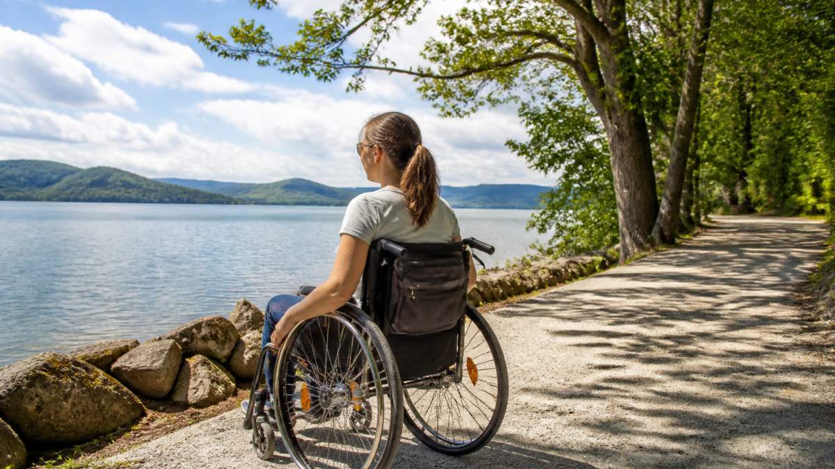
A accessible hiking trail by the lake It’s more than just a flat path. It’s a combination of a stable surface, a moderate incline, good infrastructure, and being well-maintained. With the right information and planning, people with limited mobility, wheelchair users, and families with strollers can enjoy nature.
Planning takes time. Do thorough research. Use specialized websites and up-to-date reviews. Contact the operators directly. Ask about seasonal issues.
At Ferienwohnungen Gutenbrunn, you'll find not only a accessible lodging in the Waldviertel, as well as personalized assistance with planning. Anna & Herbert know the local accessible hiking trails and can help you choose the best route for your needs. With their experience and personalized guidance, your outing will be a true nature experience—stress-free and with full support.
Frequently Asked Questions
How can I tell if a hiking trail along the lake is truly accessible?
A truly accessible hiking trail along a lake should have a paved, level surface (asphalt or compacted gravel), a maximum gradient of 6 %, and be at least 1.5 meters wide. It’s also important to have information about the trail’s condition in wet weather, plenty of rest areas with seating, and accessible restrooms nearby. User reviews and current hiking portals provide insight into the trail’s actual condition.
Where can I find reliable information about wheelchair-accessible paths along the lake?
Accessible hiking maps and tour portals provide detailed information on elevation gain, terrain, and infrastructure. Regional tourism associations often provide lists of accessible routes. User portals and reviews help you check the current conditions. Contact your local tourist information office—staff members often know firsthand which trails are truly accessible.
How do I plan a lakeside hike with a wheelchair or stroller?
Gather information in advance about the incline, trail conditions, and length. Check whether there are parking spots near the starting point and whether accessible restrooms are available. Be aware of seasonal conditions—even paved trails can be slippery after rain. Plan for rest stops and find out about swimming spots and shaded rest areas.
Which lakeside walks are particularly suitable for wheelchair users?
Circular trails along the lake shore with flat, paved surfaces are ideal—they let you enjoy nature without any inclines and allow for breaks to take in the view. Lakes with wide lakeside paths and good infrastructure (parking lots, restrooms, rest areas) are the top choice. Many regions offer special accessible lakeside paths that have been specifically designed for wheelchair users and families with strollers.


Comments are closed, but trackbacks and pingbacks are open.